I've called this post 'Reflections on teaching Neatline' but I could also have called it 'when new digital humanists meet new software'. Or perhaps even 'growing pains in the digital humanities?'.
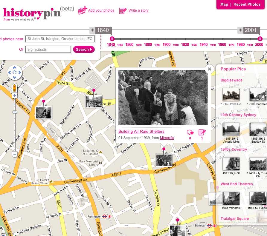
A few months ago, Anouk Lang at the University of Strathclyde asked me to lead a workshop on Neatline, software from the Scholar's Lab that plots 'archives, objects, and concepts in space and time'. It's a really exciting project, designed especially for humanists – the interfaces and processes are designed to express complexity and nuance through handcrafted exhibits that link historical materials, maps and timelines.
The workshop was on Thursday, and looking at the evaluation forms, most people found it useful but a few really struggled and teaching it was also slightly tough going. I've been thinking a lot about the possible reasons for that and I'm sharing them both as a request for others to share their experiences in similar circumstances and also in the hope that they'll help others.
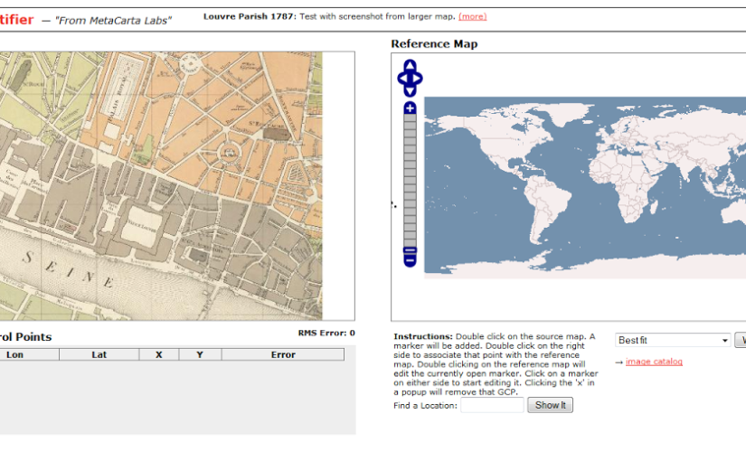
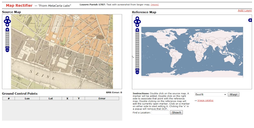
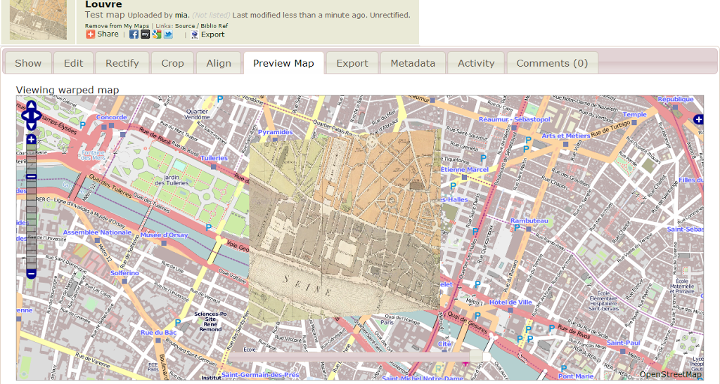
The basic outline of the workshop was an intros round (who I am, who they are and what they want to learn); information on what Neatline is and what it can do; time to explore Neatline and explore what the software can and can't do (e.g. login, follow the steps at neatline.org/plugins/neatline to create an item based on a series of correspondence Anouk had been working on, deciding whether you want to transcribe or describe the letter, tweaking its appearance or linking it to other items); and a short period for reflection and discussion (e.g. 'What kinds of interpretive decisions did you find yourself making? What delighted you? What frustrated you?') to finish. If you're curious, you can follow along with my slides and notes or try out the Neatline sandbox site.
The first half was fine but some people really struggled with the hands-on section. Some of it was to do with the software itself – as a workshop, it was a brilliant usability test of the admin interfaces of the software for audiences outside the original set of users. Neatline was only launched in July this year and isn't even in version 2 yet so it's entirely understandable that it appears to have a few functional or UX bugs. The documentation isn't integrated into the interface yet (and sometimes lacks information that is probably part of the shared tacit knowledge of people working on the project) but they have a very comprehensive page about working with Neatline items. Overall, the process of handcrafting timelines and maps for a Neatline exhibit is still closer to 'first, catch your rabbit' than making a batch of ready-mix cupcakes. Neatline is also designed for a particular view of the world, and as it's built on top of other software (Omeka) with another very particular view of the world (and hello, Dublin Core), there's a strong underlying mental model that informs the processes for creating content that is foreign to many of its potential users, including some at the workshop.
But it was also partly because I set the bar too high for the exercises and didn't provide enough structure for some of the group. If I'd designed it so they created a simple Neatline item by closely following detailed instructions (as I have done for other, more consciously tech-for-beginners workshops), at least everyone would have achieved a nice quick win and have something they could admire on the screen. From there some could have tried customising the appearance of their items in small ways, and the more adventurous could have tried a few of the potential ways to present the sample correspondence they were working with to explore the effects of their digitisation decisions. An even more pragmatic but potentially divisive solution might have been to start with the background and demonstration as I did, but then do the hands-on activity with a smaller group of people who were up for exploring uncharted waters. On a purely practical level, I also should have uploaded the images of the letters used in the exercise to my own host so that they didn't have to faff with Dropbox and Omeka records to get an online version of the image to use in Neatline.
And finally it was also because the group had really mixed ICT skills. Most were fine (bar the occasional bug), but some were not. It's always hard teaching technical subjects when participants have varying levels of skill and aptitude, but when does it go beyond aptitude into your attitude about being pushed out of your comfort zone? I'd warned everyone at the start that it was new software, but if you haven't experienced beta software before I guess you don't have the context for understanding what that actually means.
I should make it clear here that I think the participants' achievements outshine any shortcomings – Neatline is a great tool for people working with messy humanities data who want to go beyond plonking markers on Google Maps, and I think everyone got that, and most people enjoyed the chance to play with Neatline.
But more generally, I also wonder if it has to do with changing demographics in the digital humanities – increasingly, not everyone interested in DH is an early, or even a late adopter, and someone interested in DH for the funding possibilities and cool factor might not naturally enjoy unstructured exploration of new software, or be intrigued by trying out different combinations of content and functionality just 'to see what happens'.
Practically, more information for people thinking of attending would be useful – 'if you know x already, you'll be fine; if you know y already, you'll be bored' would be useful in future. Describing an event as 'if you like trying new software, this is for you' would probably help, but it looks like the digital humanities might also now be attracting people who don't particularly like working things out as they go along – are they to be excluded? If using software like this is the onboarding experience for people new to the digital humanities, they're not getting the best first impression, but how do you balance the need for fast-moving innovative work-in-progress to be a bit hacky and untidy around the edges with the desires of a wider group of digital humanities-curious scholars? Is it ok to say 'here be dragons, enter at your own risk'?